ATTN: This tutorial only works for FireFox, do not use IE, the profile website doesn
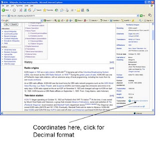
Step 1: Determine the coordinates of the transmitter (in decimal format by clicking on the coordinates in Wikipedia, uses geohack)
http://en.wikipedia.org/wiki/KOIN-TV
Step 2: Determine the coordinates of the receiver location (your house), also in decimal format. This step can be skipped as you can click directly on the map in step #3 to locate the receiver location.
http://mapki.com/getLonLat.php
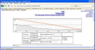
Step 3: Create a profile using the coordinates from above. Enter the coordinates as 45.51611,-122.732778
http://www.heywhatsthat.com/profiler-0904.html
Step 4: Adjust the height above terrain for the transmitter and receiver by clicking on the height hyperlink next to the coordinates.
Step 5: Note if you have line of sight (LOS) and the distance of the path. The path distance will be used later when we calculate path loss and link budgets.


1 comment:
Second tool for profile http://www.geocontext.org/publ/2010/04/profiler/en/
Post a Comment